Accelerating agricultural transformation in rural India through geospatial intelligence, Earth observation technologies, and data-driven innovation for sustainable development.
Skill Courses, Certified Students & Internships Delivered
0
Collaboration & Partnerships
About AHSIS
Bridging Innovation, Sustainability & Community
Founded in 2025, AHSIS is a DPIIT-recognized startup dedicated to bridging the gap between innovation, sustainability, and community development.
We harness the power of geospatial intelligence, Earth observation technologies, and data-driven innovation to address complex challenges in natural resource management, climate resilience, Agrotech, and rural development.
MCA RegisteredMSME CertifiedStartup India
Gallery
Subsub3AHSIS Kolkata
Geospatial Intelligence
From satellite imagery to AI-driven advisory — we bring cutting-edge technology directly to rural communities, enabling sustainable food systems and climate resilience.
Our Core Focus Areas
Driving Innovation for a Sustainable Tomorrow
At AHSIS, our core focus areas integrate geospatial technology, smart agriculture, and climate intelligence to build resilient ecosystems and empower communities.
Geospatial Technology & Innovation
Leveraging Remote Sensing, GIS, satellite-based climatology, and spatial modeling to provide transformative geospatial solutions for sustainable development.
Addressing climate resilience and rural transformation through data-driven strategies, sustainability science, and community-focused development programs.
From satellite signals to actionable rural decisions
AHSIS connects geospatial data, field validation, AI-assisted insight, and skill delivery into one practical operating model for climate-smart agriculture.
01Sense
Remote sensing, farm mapping, weather layers, and field evidence.
02Model
Crop stress, resource risk, productivity gaps, and intervention priority.
03Deploy
Training, advisory, internships, pilot projects, and partner execution.
AHSIS OSField Ready
Data to deployment
SatelliteNDVI / LULC
ClimateRisk Layers
SkillsInternship Labs
PartnersDeploy Pilots
PriorityWater Stress
ActionAdvisory + Training
What We Do
Specialization Areas
🌍
01
GIS & Remote Sensing
Advanced geospatial solutions for mapping, monitoring, and spatial decision-making using cutting-edge satellite and sensor technologies.
AHSIS Agri Innovation is a leading provider of precision agriculture and geospatial solutions designed to transform modern farming. By integrating remote sensing, GIS, IoT sensors, and AI-driven analytics, we deliver smart, data-driven insights for improved crop productivity, soil health management, and climate-resilient agriculture.
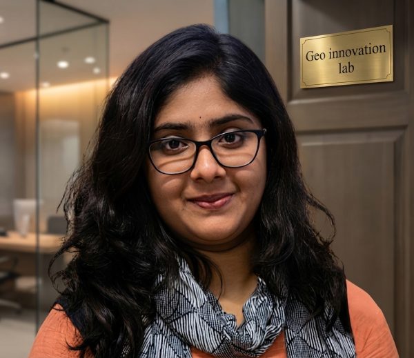
The GeoInnovation Lab (GIL) at AHSIS is a dedicated R&D hub for geospatial technologies, AI, and environmental innovation. We bridge academic research and real-world applications through prototype development, algorithm design, and advanced spatial modeling. Our lab focuses on open-source GIS tools, machine learning integration, and field-based validation. GIL supports academic collaborations, startup incubation, and government projects, driving innovation in geospatial science and sustainable development solutions.
Industry-relevant skill training designed to bridge the gap between academia and real-world challenges.
9 courses
⏱ 6 Months
Certificate Course in Geoinformatics
A comprehensive 6-month Geoinformatics certification program covering GIS Fundamentals, Remote Sensing, Spatial Data Handling, Cartography, Image Classification, DEM & Terrain Analysis, Geospatial Databases, Advanced GIS Analysis, Web GIS, GPS, Drone Applications, and Python for Geospatial Analytics. The course combines theory, practical sessions, case studies, and project-based learning using industry-standard software and real-world datasets.
No active batch
⏱ 2 Month / 20 Hours
GeoAI – Fundamentals of Spatial Artificial Intelligence
Integrate GIS with machine learning. Learn raster/vector processing, spectral indices, and classification techniques using AI.
Apply weather data and radar insights for agriculture planning, irrigation, and climate-resilient farming.
No active batch
⏱ 1 Month / 14 Hours
Drone Survey & Photogrammetry
Learn UAV mapping, aerial data acquisition, and photogrammetric processing for high-resolution spatial analysis.
No active batch
⏱ 1 Month / 16 Hours
Data Visualization & Analytics using Power BI
Master business intelligence tools to transform data into interactive dashboards and reports for decision-making.
No active batch
⏱ 1 Month / 12 Hours
Web GIS & Its Applications
Develop interactive GIS web applications using modern frameworks and cloud-based geospatial tools.
No active batch
⏱ 1 Month / 14Hours
Python Programming for GIS Applications
Learn Python programming tailored for geospatial applications. This course covers automation, spatial data analysis, and integration of GIS workflows using libraries like GeoPandas, Rasterio, and Matplotlib.
No active batch
⏱ 3 Month / 40 Hours
Geo-Heritage Mapping & Conservation
Map and conserve cultural and heritage sites using geospatial technologies and storytelling techniques.
No active batch
No courses found
Try another duration filter to view available programs.
Our Work
Projects & Research
Cutting-edge work in agriculture, geospatial analysis, and AI-driven innovation.
Projects
🌾
Remote Sensing, Machine Learning, Agriculture
A Machine Learning Approach to Rice Yield Prediction in the Kashmir Himalayas Using Remote Sensing and Climate Parameters
This research focuses on developing a machine learning-based model to predict rice yield in the Kashmir Himalayas by integrating remote sensing data and key climatic parameters. The study utilizes satellite-derived indices such as NDVI, LST, and rainfall patterns along with temperature and seasonal variability to improve yield estimation accuracy. Advanced algorithms are applied to analyze spatial and temporal patterns, enabling better crop monitoring and decision-making. The outcome aims to support farmers, policymakers, and agricultural planners with data-driven insights for enhancing productivity and ensuring climate-resilient agriculture in the region.
Maize Yield Forecasting in the Kashmir Himalayan Region Through Machine Learning Models and Satellite-Derived Climatic Variables
Forecasting maize yield in the Kashmir Himalayas using machine learning integrated with satellite-derived climatic variables like NDVI, LST, rainfall, and temperature.The study develops a data-driven model to support climate-resilient agriculture, enhance decision-making, and improve food security in mountainous regions.
Real students. Real projects. Real impact. Kickstart your career with hands-on geospatial & agri-tech experience under expert mentorship.
Research InternshipsPlacement CellCertificate Program
0
Active Interns
Our Student Interns
Research Intern
Talent Chikeya
"AHSIS is more than an internship- itis a foundation for growth, learning and professional development in geoscience"
Research Intern | AHSIS
Nisha Sharma
"Geology student with a strong interest in Paleontology, especially Vertebrate Paleontology. Passionate about understanding Earth’s past life through fossils and applying scientific knowledge to real-world geological research. Currently undertaking a two-month research internship at AHSIS, gaining hands-on exposure that bridges classroom learning with real-world geoscientific applications."
Research Intern | AHSIS
Nyran Abraham Tahija
"At AHSIS, Nyran transformed his limited knowledge of Remote Sensing & GIS into strong technical confidence through hands-on projects, mentorship, and teamwork. Inspired by fishing trips and his father’s encouragement, he pursued Fisheries & Marine Studies and is now advancing in Environmental Science. His journey reflects growth, passion, and transformation."
Research Intern | AHSIS
Reeketsehile Pius Toloane
"Inspired from a young age by hands-on water analysis, Reeketsehile developed a passion for environmental sciences. Originally from Lesotho, he is focused on water-driven environmental systems. At AHSIS, he is gaining practical experience in Remote Sensing-based environmental monitoring and GIS-supported decision-making for real-world solutions."
Research Intern | AHSIS
Riddhi Nilesh Vadher
"A passionate learner in the field of environmental and geospatial sciences, Riddhi is actively building skills in Remote Sensing and GIS. During the internship at AHSIS, she is gaining hands-on experience in data analysis, mapping, and real-world environmental applications, strengthening her foundation for a career in geospatial technology."
Research Intern | AHSIS
Shaunak Gupta Bakshi
"Getting the opportunity to work as a Research Intern at AHSIS has been a truly productive and rewarding experience for my career. As this was my first professional exposure, I initially had limited understanding of how research is conducted in practice. The mentors at AHSIS were highly supportive, helping me understand both fundamental concepts and advanced technical aspects. This experience has significantly improved my confidence, analytical abilities, and research skills. I am sincerely grateful to AHSIS for contributing to my academic and professional growth."
Research Intern | AHSIS
Anandi Bhaduri
"Working as a Research Intern at AHSIS has been an enriching and insightful journey. Being my first exposure to a professional research environment, I gained practical understanding of research methodologies and geospatial technologies. The guidance provided by the mentors helped me build a strong foundation and enhance my technical and analytical skills. This experience has boosted my confidence and prepared me for future academic and professional challenges. I am thankful to AHSIS for this valuable learning opportunity."
Research Intern | AHSIS
Sonia Bhadra
"My internship experience at AHSIS has been highly productive and transformative. As a beginner in research, I initially had limited exposure to real-world applications. However, the structured training and continuous support from mentors helped me understand key concepts in GIS and Remote Sensing. I developed strong analytical and practical skills during this period. I am grateful to AHSIS for providing such a supportive and growth-oriented environment."
Research Intern | AHSIS
Swapnanil Roy
"Getting the opportunity to work as a Research Intern at AHSIS has been a truly productive and rewarding experience for my career. As this was my first professional exposure, I initially had limited understanding of how research is conducted in practice. The mentors at AHSIS were extremely supportive, helping me understand both the fundamental concepts and technical aspects of research. Through this experience, I have developed greater confidence in my work, and my analytical and research skills have improved significantly. I am sincerely grateful to AHSIS for contributing to my academic and professional growth."
🔬
Research Internships
Work alongside industry experts on real-world research projects in geospatial tech and climate science.
Hands-on project experience
Mentorship from domain experts
Certificate upon completion
Publication opportunities
🎯
Placement Cell
Dedicated career counselling connecting students with industry partners in agritech and geospatial sectors.
150+ youth placed successfully
Industry partner network
Career counselling support
Resume & interview preparation
Milestones
Our Journey
🏢
April 2025
2025
Official Registration
AHSIS Pvt. Ltd. officially registered under MCA, MSME, and Startup India, marking the beginning of a new chapter in geospatial innovation.
🎓
May 2025
2025 • Milestone
Launch of Skill Development Courses
AHSIS initiated its first phase of skill development programs focusing on GIS, Remote Sensing, and sustainability, empowering students and professionals with industry-relevant expertise.
🌐
August 2025
2025 • Expansion
Launch of TerraSynapse Platform
AHSIS expanded into advanced geospatial innovation with the introduction of TerraSynapse, focusing on GeoAI, spatial intelligence, and next-generation data-driven solutions.
🤝
November 2025
2025 • Collaboration
Strategic Institutional Partnerships
Collaborations were established with academic institutions and organizations to enhance research, training, and real-world project implementation.
🌾
March 2026
2026 • Impact
Farmer Training & Outreach Programs
AHSIS initiated field-level training programs for farmers, promoting climate-resilient agriculture using geospatial tools, agrometeorology, and sustainable practices.
Global Impact
SDG Alignment
Dedicated to promoting sustainable development through innovation, education, and geospatial solutions aligned with the UN SDGs.
2
Zero Hunger
Climate-smart agriculture and food security solutions
4
Quality Education
Skill development and practical training programs
6
Clean Water
Water resource management through geospatial tech
7
Clean Energy
Renewable energy training and rural solutions
9
Innovation
Innovation hubs and technology incubation
13
Climate Action
Climate modeling and disaster risk management
15
Life on Land
Environmental monitoring and biodiversity mapping
17
Partnerships
Collaborative ecosystem for sustainable impact
Trusted By
Our Collaborators & Partners
Working alongside leading institutions, government bodies, and organizations to accelerate sustainable agricultural transformation.
AHSIS is where research meets real-world impact. The platform transforms academic knowledge into practical, solution-driven outcomes for sustainability and innovation.
Ms. Mahjabeen
PhD Research Scholar
"
AHSIS creates an ecosystem of innovation, mentorship, and hands-on learning—empowering students to evolve into skilled, future-ready professionals.
Ms. Insiya Mondal
Research Scholar
"
More than an internship, AHSIS is a launchpad for ideas, skills, and professional growth, driven by real-world exposure and expert guidance.
Mr. Nyran Abraham Tahija
Research Scholar
Join Us
Get Involved
🧭
Become a Member
Join AHSIS to contribute to research, innovation, workshops, webinars, and sustainable development initiatives.
💼
Work With Us
Check back for openings in research, technology, education, and community development roles across our growing team.
🤝
Partner With Us
Collaborate on projects, sponsor initiatives, or explore partnership opportunities for mutual growth and lasting impact.
Our Presence
Where We Operate
Ground operations, training centres, and research partnerships across India — bridging data and farmland.